
Pregarten topographic map
Interactive map
Click on the map to display elevation.
About this map
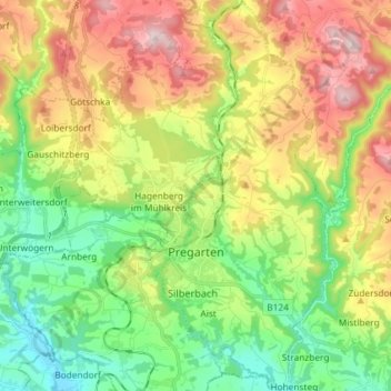
Name: Pregarten topographic map, elevation, terrain.
Location: Pregarten, Bezirk Freistadt, Upper Austria, 4230, Austria (48.32045 14.51591 48.41722 14.58315)
Average elevation: 459 m
Minimum elevation: 281 m
Maximum elevation: 725 m