Geolocate

Centerville topographic map

Click on the map to display elevation.

About this map
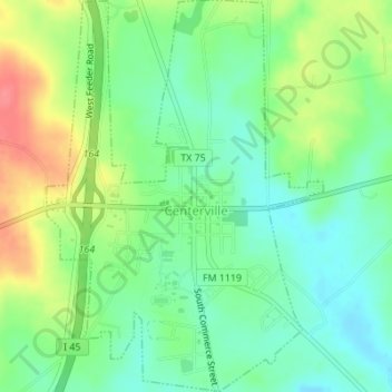
Name: Centerville topographic map, elevation, terrain.

Location: Centerville, Leon County, Texas, United States (31.24423 -95.99166 31.27356 -95.96738)

Average elevation: 109 m

Minimum elevation: 82 m

Maximum elevation: 153 m

Other topographic maps

Click on a map to view its topography, its elevation and its terrain.

Hilltop Lakes

United States > Texas > Leon County

Average elevation: 137 m

Keechi

United States > Texas > Leon County

Average elevation: 102 m

Gear up for your next adventure:

👟Men's Trail Running Shoes - Lightweight grip for fast movement over topographic contours
🦶Anti-Blister Balms - Protect your feet before long topographic expeditions
🩹Hiking First Aid Kits - Compact medical kits tailored for trail injuries and emergencies
📦Dry Bags - Waterproof bags to protect gear from rain
🔦LED Camping Lanterns - Illumination for reading maps inside your tent at night

As an Amazon Associate, this site earns from qualifying purchases at no extra cost to you.