Geolocate

Tekirdağ topographic map

Click on the map to display elevation.

About this map
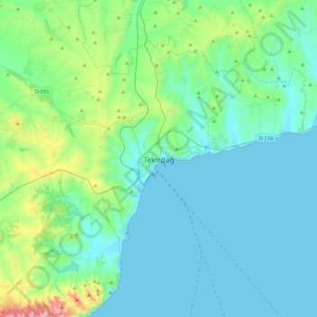
Name: Tekirdağ topographic map, elevation, terrain.

Location: Tekirdağ, Süleymanpaşa, Tekirdağ, Marmara Region, 59200, Turkey (40.81812 27.35078 41.13812 27.67078)

Average elevation: 109 m

Minimum elevation: -1 m

Maximum elevation: 708 m

Other topographic maps

Click on a map to view its topography, its elevation and its terrain.

Husunlu Mahallesi

Turkey > Süleymanpaşa

Average elevation: 105 m

Gear up for your next adventure:

🎒Backpack Rain Covers - Universal waterproof covers to protect your gear from downpours
👟Heavy Duty Boot Laces - Always carry a spare for your hiking footwear
🧭Emergency Beacons - Safety beacons for remote outdoor locations
🧥Waterproof Hiking Jackets - Rain protection for walking in all weather conditions
📍Handheld GPS Navigators - Reliable satellite navigation for hiking and off-road exploration

As an Amazon Associate, this site earns from qualifying purchases at no extra cost to you.