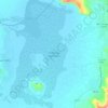
Lake Hawassa topographic map
Click on the map to display elevation.
Lake Hawassa
Lake Hawassa or Awasa, is an endorheic basin in Sidama Region of Ethiopia, located in the Main Ethiopian Rift south of Addis Ababa, the capital city of the country. According to the Statistical Abstract of Ethiopia for 1967/68, the lake is 16 km long and 9 km wide, with a surface area of 129 square kilometers. It has a maximum depth of 10 meters and is located at an elevation of 1,708 meters. It is located inside the Awasa Caldera.
About this map

Name: Lake Hawassa topographic map, elevation, terrain.
Location: Lake Hawassa, Hawassa, West Arsi, Sidama, Ethiopia (6.98444 38.38966 7.12826 38.48221)
Average elevation: 1,705 m
Minimum elevation: 1,681 m
Maximum elevation: 2,021 m
Other topographic maps
Click on a map to view its topography, its elevation and its terrain.