Geolocate

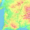
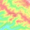
Moura topographic map

Click on the map to display elevation.

About this map

Name: Moura topographic map, elevation, terrain.

Location: Moura, Beja, Portugal (37.96061 -7.53278 38.33115 -6.98683)

Average elevation: 189 m

Minimum elevation: 45 m

Maximum elevation: 512 m

Other topographic maps

Click on a map to view its topography, its elevation and its terrain.

Tamera

Portugal > Beja > Odemira > Relíquias

Average elevation: 170 m

Corvatos

Portugal > Beja > Almodôvar

Average elevation: 329 m

Alentejo Region

Portugal > Beja > Beja

Average elevation: 170 m

Pardieiro

Portugal > Beja > Almodôvar > São Barnabé

Average elevation: 228 m

Ourique

Portugal > Beja > Ourique > Ourique

Average elevation: 203 m

Serpa

Portugal > Beja

Average elevation: 168 m

Velha

Portugal > Beja > Odemira

Average elevation: 167 m

Noudar

Portugal > Beja > Barrancos

Average elevation: 199 m

Zambujeira

Portugal > Beja > Odemira

Average elevation: 257 m

Longueira

Portugal > Beja > Odemira

Average elevation: 41 m

São Miguel do Pinheiro

Portugal > Beja > Mértola

Average elevation: 192 m

Colorada

Portugal > Beja > Barrancos

Average elevation: 276 m

Fontinha

Portugal > Beja > Odemira

Average elevation: 169 m

Odemira

Portugal > Beja > São Salvador e Santa Maria > Odemira

Average elevation: 67 m

Almograve

Portugal > Beja > Odemira

Average elevation: 28 m

Soeiras

Portugal > Beja > São Barnabé

Average elevation: 383 m

Gear up for your next adventure:

🗺️Topographic Maps - Detailed maps showing elevation and terrain features
🧘Folding Sit Mats - Dry and warm seat for map-reading breaks on damp ground
🧦Hiking Socks - Breathable socks designed to prevent blisters on long walks
🧢Waterproof Hiking Hats - Keep the rain off your face while studying topographic maps
🧊Personal Water Filters - Drink safely from mountain streams marked on your map

As an Amazon Associate, this site earns from qualifying purchases at no extra cost to you.