Geolocate

Devgad topographic map

Click on the map to display elevation.

About this map

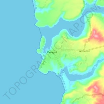
Name: Devgad topographic map, elevation, terrain.

Location: Devgad, Devgad Taluka, Sindhudurg, Maharashtra, 416613, India (16.33704 73.33962 16.41704 73.41962)

Average elevation: 24 m

Minimum elevation: -5 m

Maximum elevation: 142 m

Other topographic maps

Click on a map to view its topography, its elevation and its terrain.

GIRYE MINI BEACH

India > Maharashtra > Devgad Taluka

Average elevation: 29 m

Gear up for your next adventure:

📻Hand-Crank Emergency Radios - Stay updated on weather warnings in remote areas
🐕Hiking Dog Harnesses - Rugged harnesses for taking your companion on mountain trails
🔋Solar Power Banks - Keep your GPS and phone charged during multi-day expeditions
🧺Mesh Stuff Sacks - Breathable storage for wet gear or camp organization
🚲Cycling GPS Computers - Track elevation and topographic routes on two wheels

As an Amazon Associate, this site earns from qualifying purchases at no extra cost to you.