
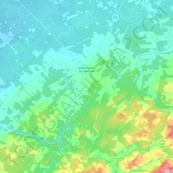
Sainte-Agathe-de-Lotbinière topographic map
Interactive map
Click on the map to display elevation.
About this map
Name: Sainte-Agathe-de-Lotbinière topographic map, elevation, terrain.
Average elevation: 195 m
Minimum elevation: 138 m
Maximum elevation: 436 m
Other topographic maps
Click on a map to view its topography, its elevation and its terrain.
Saint-Patrice-de-Beaurivage
Canada > Quebec > Lotbinière (MRC)
Saint-Patrice-de-Beaurivage, Lotbinière (MRC), Chaudière-Appalaches, Quebec, G0S 1B0, Canada
Average elevation: 215 m