
Thank you for supporting this site ❤️
Make a donation
Make a donation
Gear up for your next adventure:
As an Amazon Associate, this site earns from qualifying purchases at no extra cost to you.
Vedum topographic map
Click on the map to display elevation.
Thank you for supporting this site ❤️
Make a donation
Make a donation
Gear up for your next adventure:
As an Amazon Associate, this site earns from qualifying purchases at no extra cost to you.
About this map
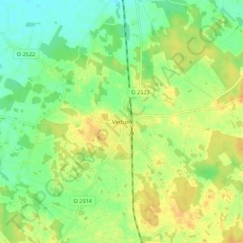
Name: Vedum topographic map, elevation, terrain.
Location: Vedum, Vara kommun, Västra Götaland County, 530 10, Sweden (58.15104 12.97557 58.19104 13.01557)
Average elevation: 104 m
Minimum elevation: 90 m
Maximum elevation: 118 m
Thank you for supporting this site ❤️
Make a donation
Make a donation
Gear up for your next adventure:
As an Amazon Associate, this site earns from qualifying purchases at no extra cost to you.