Geolocate

Enoshima topographic map

Click on the map to display elevation.

About this map

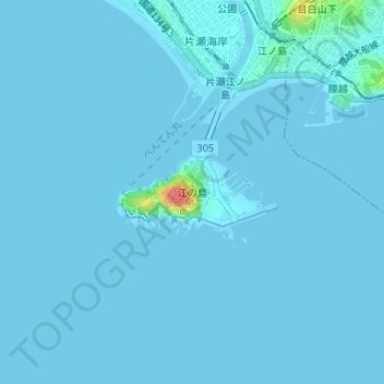
Name: Enoshima topographic map, elevation, terrain.

Location: Enoshima, Fujisawa, Kanagawa Prefecture, 251-0036, Japan (35.29721 139.47412 35.30300 139.48804)

Average elevation: 2 m

Minimum elevation: -6 m

Maximum elevation: 62 m

Gear up for your next adventure:

📷Camera Straps - Secure straps for carrying cameras while walking
🧺Microfibre Travel Towels - Fast-drying and compact towels for wild swimming and camping
🥾Women's Waterproof Hiking Boots - High-performance trekking boots designed for all-weather comfort
👖Convertible Hiking Trousers - Versatile zip-off pants for changing mountain weather conditions
🛌Sleeping Mats - Insulated mats for comfortable outdoor sleeping

As an Amazon Associate, this site earns from qualifying purchases at no extra cost to you.