
Pavón topographic map
Interactive map
Click on the map to display elevation.
About this map
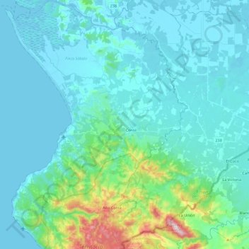
Name: Pavón topographic map, elevation, terrain.
Location: Pavón, Cantón Golfito, Puntarenas Province, 60704, Costa Rica (8.33701 -83.15145 8.55561 -82.98939)
Average elevation: 87 m
Minimum elevation: 0 m
Maximum elevation: 643 m