
Wólka Smoszewska topographic map
Interactive map
Click on the map to display elevation.
About this map
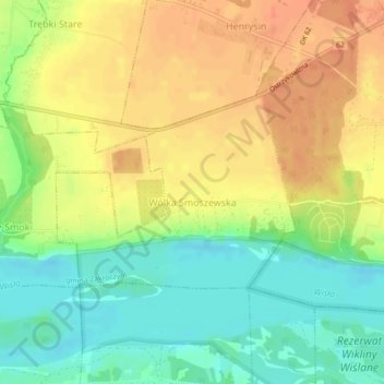
Name: Wólka Smoszewska topographic map, elevation, terrain.
Average elevation: 86 m
Minimum elevation: 62 m
Maximum elevation: 108 m
Other topographic maps
Click on a map to view its topography, its elevation and its terrain.
Modlin Fortress
Poland > Masovian Voivodeship > Nowy Dwór Mazowiecki County > Nowy Dwór Mazowiecki
Average elevation: 91 m