Geolocate

Progreso topographic map

Click on the map to display elevation.

About this map

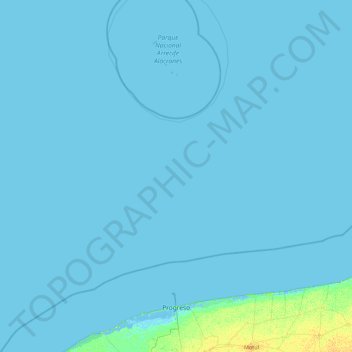
Name: Progreso topographic map, elevation, terrain.

Location: Progreso, Yucatán, Mexico (21.26407 -91.40010 22.52896 -89.62450)

Average elevation: 1 m

Minimum elevation: -4 m

Maximum elevation: 13 m

Gear up for your next adventure:

👕Technical Hiking Tees - Moisture-management for high-exertion climbs
🕶️Glacier Goggles - Maximum protection for high-altitude snow topography
🎒Replacement Sternum Straps - Repair parts for hiking rucksacks
🧣Neck Gaiters - Protects against wind and sun on exposed ridges and peaks
🗺️Topographic Maps - Detailed maps showing elevation and terrain features

As an Amazon Associate, this site earns from qualifying purchases at no extra cost to you.