Geolocate

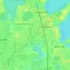
Lake Inwood topographic map

Click on the map to display elevation.

About this map

Name: Lake Inwood topographic map, elevation, terrain.

Location: Lake Inwood, Pine Castle, Conway, Orange County, Florida, United States (28.49577 -81.33564 28.49760 -81.33329)

Average elevation: 33 m

Minimum elevation: 21 m

Maximum elevation: 44 m

Other topographic maps

Click on a map to view its topography, its elevation and its terrain.
Oak Ridge

United States > Florida > Orange County > Pine Castle

Average elevation: 31 m

Gear up for your next adventure:

🪢Paracord - Multi-purpose cord for camping and survival
🗺️Ordnance Survey Maps - Essential paper maps for hiking across the UK national parks
🎿Telescopic Trekking Poles - Reduces knee strain on steep topographic descents
🕶️Glacier Goggles - Maximum protection for high-altitude snow topography
🧺Microfibre Travel Towels - Fast-drying and compact towels for wild swimming and camping

As an Amazon Associate, this site earns from qualifying purchases at no extra cost to you.