
Orefield topographic map
Interactive map
Click on the map to display elevation.
About this map
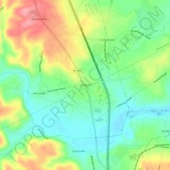
Name: Orefield topographic map, elevation, terrain.
Average elevation: 141 m
Minimum elevation: 98 m
Maximum elevation: 207 m
Other topographic maps
Click on a map to view its topography, its elevation and its terrain.
Ormrod
United States > Pennsylvania > Lehigh County > North Whitehall Township
Ormrod, North Whitehall Township, Lehigh County, Pennsylvania, 18037, United States
Average elevation: 148 m