
West Hallam topographic map
Interactive map
Click on the map to display elevation.
About this map
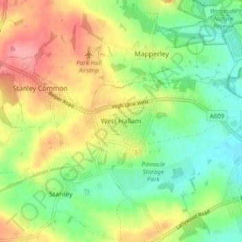
Name: West Hallam topographic map, elevation, terrain.
Average elevation: 91 m
Minimum elevation: 51 m
Maximum elevation: 142 m
Other topographic maps
Click on a map to view its topography, its elevation and its terrain.
Cotmanhay
United Kingdom > England > Derbyshire > Borough of Erewash
Cotmanhay, Borough of Erewash, Derbyshire, England, DE7 8QS, United Kingdom
Average elevation: 71 m