
L'Anse Township topographic map
Interactive map
Click on the map to display elevation.
About this map
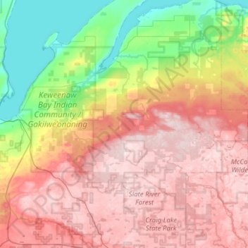
Name: L'Anse Township topographic map, elevation, terrain.
Average elevation: 388 m
Minimum elevation: 175 m
Maximum elevation: 600 m
Other topographic maps
Click on a map to view its topography, its elevation and its terrain.
Mount Arvon
United States > Michigan > Baraga County
Mount Arvon, L'Anse Township, Baraga County, Michigan, United States
Average elevation: 526 m
Aura
United States > Michigan > Baraga County > Aura
Aura, L'Anse Township, Baraga County, Michigan, United States
Average elevation: 240 m
L'Anse
United States > Michigan > Baraga County > L'Anse
L'Anse, L'Anse Township, Baraga County, Michigan, 49946, United States
Average elevation: 224 m
Ruth Lake
United States > Michigan > Baraga County > Three Lakes
Ruth Lake, Three Lakes, Spurr Township, Baraga County, Michigan, United States
Average elevation: 507 m