Geolocate

Pazos topographic map

Click on the map to display elevation.

About this map
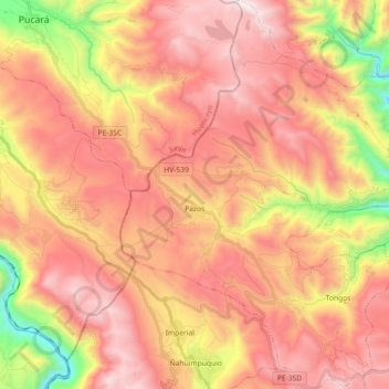
Name: Pazos topographic map, elevation, terrain.

Location: Pazos, Province of Tayacaja, Huancavelica, Peru (-12.34156 -75.10522 -12.16408 -74.94253)

Average elevation: 3,884 m

Minimum elevation: 2,998 m

Maximum elevation: 4,485 m

Other topographic maps

Click on a map to view its topography, its elevation and its terrain.

Tipicocha

Peru > Huancavelica > Chupamarca

Average elevation: 4,571 m

Gear up for your next adventure:

🌄Compact Monoculars - Lightweight optics for hiking
🥼Base Layers - Thermal base layers for temperature regulation
🍲Portable Camping Stoves - Fast-boiling stoves for hot meals on remote topographic survey trips
🧣Neck Gaiters - Protects against wind and sun on exposed ridges and peaks
🧦Hiking Socks - Breathable socks designed to prevent blisters on long walks

As an Amazon Associate, this site earns from qualifying purchases at no extra cost to you.