Geolocate

Blessac topographic map

Click on the map to display elevation.

About this map
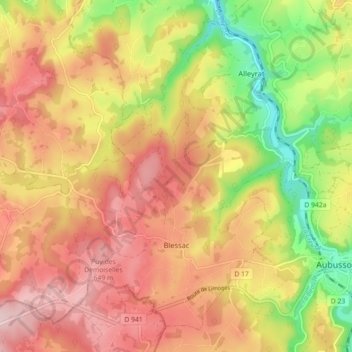
Name: Blessac topographic map, elevation, terrain.

Location: Blessac, Aubusson, Creuse, Nouvelle-Aquitaine, Metropolitan France, 23200, France (45.94356 2.06470 45.99830 2.15393)

Average elevation: 543 m

Minimum elevation: 400 m

Maximum elevation: 653 m

Other topographic maps

Click on a map to view its topography, its elevation and its terrain.

Fursac

France > Nouvelle-Aquitaine > Creuse

Average elevation: 353 m

Bonnefond

France > Nouvelle-Aquitaine > Creuse > Janaillat

Average elevation: 532 m

Gear up for your next adventure:

🧣Neck Gaiters - Protects against wind and sun on exposed ridges and peaks
🧢Hiking Hats - Sun and weather protection for outdoor walks
⌚GPS Outdoor Watches - Watches with GPS tracking for hiking and exploration
📸Action Camera Chest Mounts - Record your ascent following topographic paths hands-free
🖼️Topographic Map Art - Decorative 3D-effect posters of famous UK peaks and regions

As an Amazon Associate, this site earns from qualifying purchases at no extra cost to you.