
Bedford topographic map
Click on the map to display elevation.
About this map
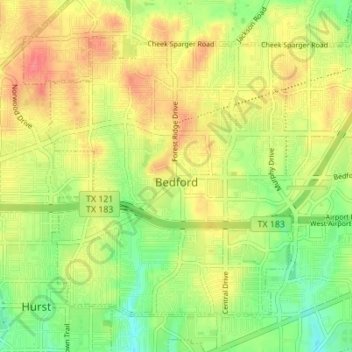
Name: Bedford topographic map, elevation, terrain.
Location: Bedford, Tarrant County, Texas, United States (32.82209 -97.16863 32.86776 -97.10018)
Average elevation: 180 m
Minimum elevation: 150 m
Maximum elevation: 208 m
Other topographic maps
Click on a map to view its topography, its elevation and its terrain.
Will Rogers Memorial Center
United States > Texas > Tarrant County > Fort Worth
Average elevation: 181 m