Geolocate

Quorn topographic map

Click on the map to display elevation.

About this map
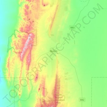
Name: Quorn topographic map, elevation, terrain.

Location: Quorn, The Flinders Ranges Council, South Australia, 5433, Australia (-32.49064 137.95817 -32.21703 138.15701)

Average elevation: 311 m

Minimum elevation: 72 m

Maximum elevation: 834 m

Other topographic maps

Click on a map to view its topography, its elevation and its terrain.

Gear up for your next adventure:

🔥Reusable Hand Warmers - Maintain dexterity in your fingers for precise map handling
🔦LED Camping Lanterns - Illumination for reading maps inside your tent at night
🧼Camping Hygiene Kits - Compact hygiene essentials for outdoor stays
🔥Emergency Fire Starters - Reliable ignition tools for survival situations in damp conditions
🎒Hiking Daypacks (20L) - Compact backpacks for day trips and technical mountain ascents

As an Amazon Associate, this site earns from qualifying purchases at no extra cost to you.