
Thank you for supporting this site ❤️
Make a donation
Make a donation
Gear up for your next adventure:
As an Amazon Associate, this site earns from qualifying purchases at no extra cost to you.
Bautzen - Budyšin topographic map
Click on the map to display elevation.
Thank you for supporting this site ❤️
Make a donation
Make a donation
Gear up for your next adventure:
As an Amazon Associate, this site earns from qualifying purchases at no extra cost to you.
About this map
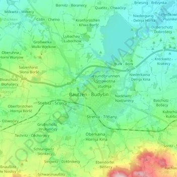
Name: Bautzen - Budyšin topographic map, elevation, terrain.
Location: Bautzen - Budyšin, Saxony, 02625, Germany (51.13727 14.32407 51.23207 14.49264)
Average elevation: 210 m
Minimum elevation: 143 m
Maximum elevation: 425 m
Thank you for supporting this site ❤️
Make a donation
Make a donation
Gear up for your next adventure:
As an Amazon Associate, this site earns from qualifying purchases at no extra cost to you.