
Thank you for supporting this site ❤️
Make a donation
Make a donation
Gear up for your next adventure:
As an Amazon Associate, this site earns from qualifying purchases at no extra cost to you.
Carberry topographic map
Click on the map to display elevation.
Thank you for supporting this site ❤️
Make a donation
Make a donation
Gear up for your next adventure:
As an Amazon Associate, this site earns from qualifying purchases at no extra cost to you.
About this map
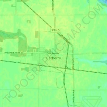
Name: Carberry topographic map, elevation, terrain.
Location: Carberry, Division No. 7, Manitoba, Canada (49.86197 -99.38225 49.88024 -99.31482)
Average elevation: 385 m
Minimum elevation: 377 m
Maximum elevation: 389 m
Thank you for supporting this site ❤️
Make a donation
Make a donation
Gear up for your next adventure:
As an Amazon Associate, this site earns from qualifying purchases at no extra cost to you.
Other topographic maps
Click on a map to view its topography, its elevation and its terrain.
Souris
Canada > Manitoba > Division No. 7 > Municipality of Souris – Glenwood
Average elevation: 433 m