Geolocate

Appledore topographic map

Click on the map to display elevation.

About this map
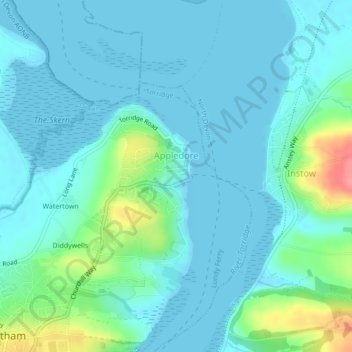
Name: Appledore topographic map, elevation, terrain.

Location: Appledore, Northam, Torridge District, Devon, Devon and Torbay, England, United Kingdom (51.04514 -4.20334 51.05959 -4.18333)

Average elevation: 14 m

Minimum elevation: -1 m

Maximum elevation: 81 m

Devon trails, hiking, mountain biking, running and outdoor activities

Other topographic maps

Click on a map to view its topography, its elevation and its terrain.

Diddywells

United Kingdom > England > Devon > Torridge District > Northam

Average elevation: 19 m

Diddywells

United Kingdom > England > Devon > Torridge District > Northam

Average elevation: 19 m

Gear up for your next adventure:

🧊Insulated Flasks - Keeps drinks hot or cold during hikes
🧺Mesh Stuff Sacks - Breathable storage for wet gear or camp organization
🧺Ultralight Dry Bags - Organize and waterproof your gear inside your rucksack
🥾Men's Waterproof Hiking Boots - Durable footwear with deep lugs for muddy and rocky UK terrains
🗺️Topographic Maps - Detailed maps showing elevation and terrain features

As an Amazon Associate, this site earns from qualifying purchases at no extra cost to you.