Geolocate

General Escobedo topographic map

Click on the map to display elevation.

About this map
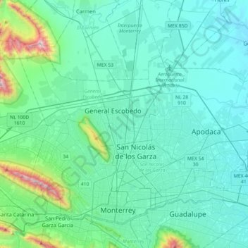
Name: General Escobedo topographic map, elevation, terrain.

Location: General Escobedo, Nuevo León, 66053, Mexico (25.64852 -100.48243 25.96852 -100.16243)

Average elevation: 595 m

Minimum elevation: 370 m

Maximum elevation: 2,034 m

Gear up for your next adventure:

🗺️Ordnance Survey Maps - Essential paper maps for hiking across the UK national parks
🛑Emergency Bivvy Bags - Heat-reflective survival bags for unexpected nights out
🧤Hiking Gloves - Warm and durable gloves for cold-weather walks
👖Convertible Hiking Trousers - Versatile zip-off pants for changing mountain weather conditions
🪓Outdoor Multitools - Versatile tools for hiking and camping

As an Amazon Associate, this site earns from qualifying purchases at no extra cost to you.