Geolocate

90403 topographic map

Click on the map to display elevation.

About this map

Name: 90403 topographic map, elevation, terrain.

Location: 90403, Nuremberg, Bavaria, Germany (49.44986 11.06912 49.45969 11.08933)

Average elevation: 315 m

Minimum elevation: 295 m

Maximum elevation: 339 m

Other topographic maps

Click on a map to view its topography, its elevation and its terrain.
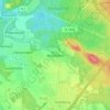
Worzeldorf

Germany > Bavaria > Nuremberg

Average elevation: 341 m

Gear up for your next adventure:

🧦Merino Wool Hiking Socks - Moisture-wicking socks to prevent blisters during long mountain walks
🧊Insulated Flasks - Keeps drinks hot or cold during hikes
🐕Dog Hiking Gear - Equipment for hiking safely with dogs
📱Rugged Phone Cases - Heavy-duty protection for smartphones used as secondary GPS tools
🛌Sleeping Bags - Warm and packable sleeping bags for outdoor nights

As an Amazon Associate, this site earns from qualifying purchases at no extra cost to you.