
San Blas topographic map
Interactive map
Click on the map to display elevation.
About this map
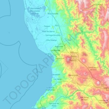
Name: San Blas topographic map, elevation, terrain.
Location: San Blas, Nayarit, Mexico (21.29180 -106.68773 21.77510 -105.02224)
Average elevation: 413 m
Minimum elevation: -2 m
Maximum elevation: 2,385 m