
Carrollton topographic map
Interactive map
Click on the map to display elevation.
About this map
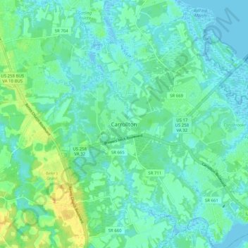
Name: Carrollton topographic map, elevation, terrain.
Average elevation: 7 m
Minimum elevation: -6 m
Maximum elevation: 23 m
Other topographic maps
Click on a map to view its topography, its elevation and its terrain.
Smithfield
United States > Virginia > Isle of Wight County
Smithfield, Isle of Wight County, Virginia, 23430, United States
Average elevation: 11 m
James River
United States > Virginia > Isle of Wight County
James River, Isle of Wight County, Virginia, United States
Average elevation: 13 m