
Hiwassee topographic map
Interactive map
Click on the map to display elevation.
About this map
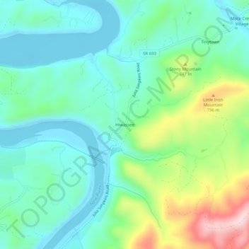
Name: Hiwassee topographic map, elevation, terrain.
Location: Hiwassee, Pulaski County, Virginia, 24347, United States (36.94873 -80.73368 36.98873 -80.69368)
Average elevation: 654 m
Minimum elevation: 562 m
Maximum elevation: 902 m
Other topographic maps
Click on a map to view its topography, its elevation and its terrain.
Lake Powhatan
United States > Virginia > Pulaski County
Lake Powhatan, Pulaski County, Virginia, United States
Average elevation: 723 m