

Alūksne topographic map
Click on the map to display elevation.
Alūksne
Alūksne (German: Marienburg)) is a town on the shores of Lake Alūksne in northeastern Latvia near the borders with Estonia and Russia. It is the seat of Alūksne municipality. Alūksne is the highest elevated Latvian city, located in East Vidzeme Upland at 217 m above sea level. The high elevation of the city affects the social and physical arrangement of the place.
About this map
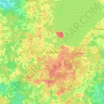
Name: Alūksne topographic map, elevation, terrain.
Location: Alūksne, Alūksnes novads, Vidzeme, LV-4301, Latvia (57.38048 27.01051 57.46048 27.09051)
Average elevation: 187 m
Minimum elevation: 154 m
Maximum elevation: 224 m