Geolocate

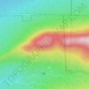
Chartierville topographic map

Click on the map to display elevation.

About this map
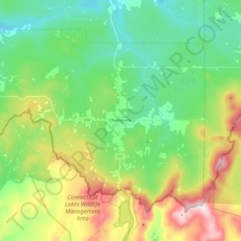
Name: Chartierville topographic map, elevation, terrain.

Location: Chartierville, Le Haut-Saint-François, Estrie, Quebec, J0B 1K0, Canada (45.23944 -71.34035 45.35178 -71.13092)

Average elevation: 591 m

Minimum elevation: 385 m

Maximum elevation: 1,018 m

Other topographic maps

Click on a map to view its topography, its elevation and its terrain.
Island Brook

Canada > Quebec > Le Haut-Saint-François > Newport

Average elevation: 340 m

Island Brook

Canada > Quebec > Le Haut-Saint-François > Newport

Average elevation: 340 m

Maple Leaf

Canada > Quebec > Le Haut-Saint-François > Newport

Average elevation: 379 m

Gould

Canada > Quebec > Le Haut-Saint-François > Lingwick

Average elevation: 322 m

Gear up for your next adventure:

📷Outdoor Action Cameras - Cameras designed for hiking and adventure
💧Hydration Reservoirs - Convenient water bladders for hands-free drinking on the move
🧴Tick Removal Tools - Small, essential health tool for UK woodland and moorland
🥄Titanium Camping Sporks - The ultimate lightweight utensil for trail meals
🌦️Portable Weather Meters - Handheld tools for monitoring weather conditions

As an Amazon Associate, this site earns from qualifying purchases at no extra cost to you.