Geolocate

Kjerag topographic map

Click on the map to display elevation.

About this map
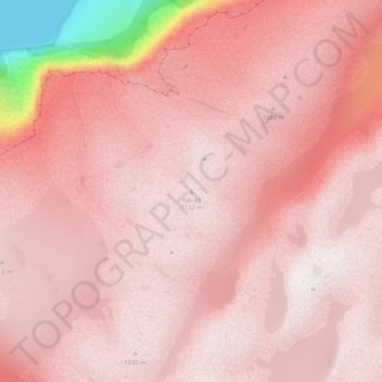
Name: Kjerag topographic map, elevation, terrain.

Location: Kjerag, Sandnes, Rogaland, Norway (59.02627 6.59563 59.02637 6.59573)

Average elevation: 970 m

Minimum elevation: 0 m

Maximum elevation: 1,162 m

Other topographic maps

Click on a map to view its topography, its elevation and its terrain.
Lysefjorden

Norway > Rogaland

Average elevation: 562 m

Stavanger

Norway > Rogaland

The municipality of Stavanger is located in a coastal landscape, bordering the sea to the west and Boknafjorden in the northeast. The Byfjorden and Gandsfjorden run along the east side of the city. It is part of the Low-Jæren, a flat area of land consisting mostly of marsh, sand, and stone aur, that ranges…

Average elevation: 42 m
Time

Norway > Rogaland

Average elevation: 137 m

Sandnes

Norway > Rogaland

Average elevation: 523 m

Hundvåg

Norway > Rogaland > Stavanger

Average elevation: 7 m

Haugesund

Norway > Rogaland

Average elevation: 13 m

Karmøy

Norway > Rogaland

Average elevation: 16 m

Vindafjord

Norway > Rogaland

Average elevation: 180 m

Sandnes

Norway > Rogaland

Average elevation: 523 m

Tysvær

Norway > Rogaland

Average elevation: 66 m

Sola

Norway > Rogaland

Average elevation: 4 m

Randaberg

Norway > Rogaland

Average elevation: 5 m

Pulpit Rock

Norway > Rogaland

Average elevation: 310 m

Pulpit Rock

Norway > Rogaland

Average elevation: 299 m

Pulpit Rock

Norway > Rogaland

Average elevation: 291 m

Stavanger

Norway > Rogaland

The municipality of Stavanger is located in a coastal landscape, bordering the sea to the west and Boknafjorden in the northeast. The Byfjorden and Gandsfjorden run along the east side of the city. It is part of the Low-Jæren, a flat area of land consisting mostly of marsh, sand, and stone aur, that ranges…

Average elevation: 37 m

Stavanger

Norway > Rogaland

The municipality of Stavanger is located in a coastal landscape, bordering the sea to the west and Boknafjorden in the northeast. The Byfjorden and Gandsfjorden run along the east side of the city. It is part of the Low-Jæren, a flat area of land consisting mostly of marsh, sand, and stone aur, that ranges…

Average elevation: 42 m
Lund

Norway > Rogaland

Average elevation: 302 m

Karmøy

Norway > Rogaland

Average elevation: 13 m

Utsira

Norway > Rogaland

Average elevation: 0 m

Line

Norway > Rogaland > Stavanger > Bru

Average elevation: 5 m

Frafjord

Norway > Rogaland > Dirdal

Average elevation: 361 m

Ørsdalen

Norway > Rogaland

Average elevation: 556 m

Stavanger

Norway > Rogaland

The municipality of Stavanger is located in a coastal landscape, bordering the sea to the west and Boknafjorden in the northeast. The Byfjorden and Gandsfjorden run along the east side of the city. It is part of the Low-Jæren, a flat area of land consisting mostly of marsh, sand, and stone aur, that ranges…

Average elevation: 42 m
Sokndal

Norway > Rogaland

Average elevation: 56 m

Norway > Rogaland

Average elevation: 35 m

Klepp

Norway > Rogaland

Average elevation: 5 m

Bokn

Norway > Rogaland

Average elevation: 7 m

Karmøy

Norway > Rogaland

Average elevation: 13 m

Sauda

Norway > Rogaland

Average elevation: 793 m

Hjelmeland

Norway > Rogaland

Average elevation: 585 m

Madla

Norway > Rogaland > Stavanger

Average elevation: 28 m

Eigersund

Norway > Rogaland

Average elevation: 88 m

Bjerkreim

Norway > Rogaland

Average elevation: 348 m

Gear up for your next adventure:

🧴Tick Removal Tools - Small, essential health tool for UK woodland and moorland
🔋Solar Power Banks - Keep your GPS and phone charged during multi-day expeditions
🧭Professional Hiking Compasses - High-precision liquid-filled compasses for map reading and orientation
🦶Anti-Blister Balms - Protect your feet before long topographic expeditions
🔪Outdoor Multi-Tools - Versatile tools for gear repairs and food prep in the wild

As an Amazon Associate, this site earns from qualifying purchases at no extra cost to you.