South Bend topographic map
Click on the map to display elevation.
South Bend
On September 29, 1929, South Bend completed its "track elevation program". This was a railroad infrastructure project which saw the removal of Grand Trunk Western Railroad tracks from Division Street, the removal of level crossings from Chapin to Miami streets, the creation of a modern freight layout, and the construction of Union Station. This project had been seventeen years in the making, and had been the subject of the Indiana Supreme Court case Vandalia Railroad v. South Bend, which was subsequently affirmed by the Supreme Court of the United States.
About this map
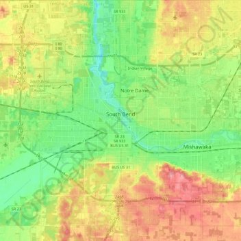
Name: South Bend topographic map, elevation, terrain.
Location: South Bend, Saint Joseph County, Indiana, United States (41.59745 -86.36075 41.76027 -86.19129)
Average elevation: 236 m
Minimum elevation: 199 m
Maximum elevation: 283 m
Other topographic maps
Click on a map to view its topography, its elevation and its terrain.