Geolocate

Blue topographic map

Click on the map to display elevation.

About this map
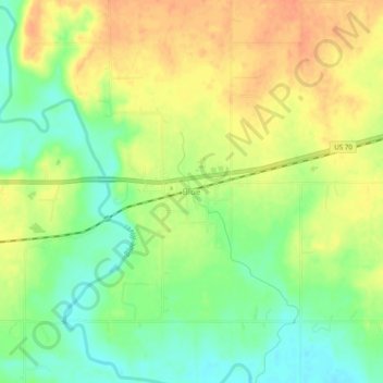
Name: Blue topographic map, elevation, terrain.

Location: Blue, Bryan County, Oklahoma, 74726, United States (33.97649 -96.24999 34.01649 -96.20999)

Average elevation: 177 m

Minimum elevation: 155 m

Maximum elevation: 196 m

Other topographic maps

Click on a map to view its topography, its elevation and its terrain.

Durant

United States > Oklahoma > Bryan County

Average elevation: 204 m

Calera

United States > Oklahoma > Bryan County

Average elevation: 211 m

Denison Dam

United States > Oklahoma > Bryan County > Cartwright

Average elevation: 181 m

Achille

United States > Oklahoma > Bryan County

Average elevation: 195 m

Durant

United States > Oklahoma > Bryan County

Average elevation: 204 m

Gear up for your next adventure:

🦟Anti-Midge & Tick Repellent - Vital for hiking in the Scottish Highlands during summer
👟Men's Trail Running Shoes - Lightweight grip for fast movement over topographic contours
🧊Personal Water Filters - Drink safely from mountain streams marked on your map
⛺Lightweight Solo Tents - Backpacking tents designed for wild camping in the UK highlands
🕶️Polarized Sunglasses - Reduces glare from snow and water when reading terrain

As an Amazon Associate, this site earns from qualifying purchases at no extra cost to you.