
Lianhua Sub-district topographic map
Interactive map
Click on the map to display elevation.
About this map
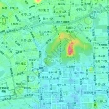
Name: Lianhua Sub-district topographic map, elevation, terrain.
Average elevation: 21 m
Minimum elevation: -2 m
Maximum elevation: 103 m
Other topographic maps
Click on a map to view its topography, its elevation and its terrain.
Lianhuashan Park
China > Guangdong Province > Futian District > Lianhua Sub-district
Lianhuashan Park, Lianhua Sub-district, Futian District, Shenzhen, Guangdong Province, 518000, China
Average elevation: 22 m