
Thank you for supporting this site ❤️
Make a donation
Make a donation
Gear up for your next adventure:
As an Amazon Associate, this site earns from qualifying purchases at no extra cost to you.
Orchha topographic map
Click on the map to display elevation.
Thank you for supporting this site ❤️
Make a donation
Make a donation
Gear up for your next adventure:
As an Amazon Associate, this site earns from qualifying purchases at no extra cost to you.
About this map
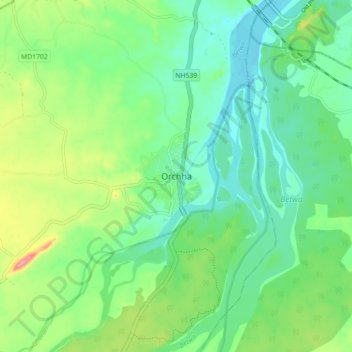
Name: Orchha topographic map, elevation, terrain.
Location: Orchha, Orchha Tahsil, Niwari, Madhya Pradesh, 472246, India (25.31287 78.60025 25.39287 78.68025)
Average elevation: 227 m
Minimum elevation: 192 m
Maximum elevation: 307 m
Thank you for supporting this site ❤️
Make a donation
Make a donation
Gear up for your next adventure:
As an Amazon Associate, this site earns from qualifying purchases at no extra cost to you.