
Thank you for supporting this site ❤️
Make a donation
Make a donation
Gear up for your next adventure:
As an Amazon Associate, this site earns from qualifying purchases at no extra cost to you.
Likir topographic map
Click on the map to display elevation.
Thank you for supporting this site ❤️
Make a donation
Make a donation
Gear up for your next adventure:
As an Amazon Associate, this site earns from qualifying purchases at no extra cost to you.
About this map
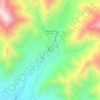
Name: Likir topographic map, elevation, terrain.
Location: Likir, Khaltsi, Leh district, Ladakh, India (34.27054 77.19109 34.31054 77.23109)
Average elevation: 3,880 m
Minimum elevation: 3,431 m
Maximum elevation: 4,683 m
Thank you for supporting this site ❤️
Make a donation
Make a donation
Gear up for your next adventure:
As an Amazon Associate, this site earns from qualifying purchases at no extra cost to you.