Geolocate

Ragby Plantation topographic map

Click on the map to display elevation.

About this map
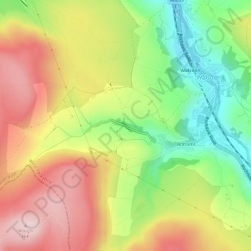
Name: Ragby Plantation topographic map, elevation, terrain.

Location: Ragby Plantation, Bottoms, Todmorden, Walsden, Calderdale, West Yorkshire, England, United Kingdom (53.68896 -2.12419 53.69086 -2.11239)

Average elevation: 293 m

Minimum elevation: 148 m

Maximum elevation: 436 m

England trails, hiking, mountain biking, running and outdoor activities

Gear up for your next adventure:

🥤Hydration Bladders - Hands-free hydration systems for backpacks
🗺️Ordnance Survey Maps - Essential paper maps for hiking across the UK national parks
🧼Biodegradable Soap - Leave-no-trace hygiene for multi-day mountain treks
🗺️Topographic Maps - Detailed maps showing elevation and terrain features
🧤Waterproof Overmitts - Extreme weather protection for hikers and mountaineers

As an Amazon Associate, this site earns from qualifying purchases at no extra cost to you.