Geolocate

Venus topographic map

Click on the map to display elevation.

About this map
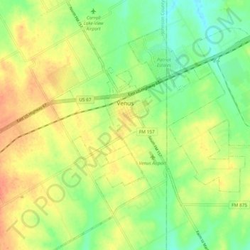
Name: Venus topographic map, elevation, terrain.

Location: Venus, Johnson County, Texas, 76084, United States (32.38686 -97.15672 32.46605 -97.06967)

Average elevation: 200 m

Minimum elevation: 177 m

Maximum elevation: 223 m

Other topographic maps

Click on a map to view its topography, its elevation and its terrain.

Highland

United States > Texas > Johnson County

Average elevation: 198 m

Turkey Peak

United States > Texas > Johnson County > Burleson

Average elevation: 237 m

Oak Hill

United States > Texas > Johnson County > Cleburne

Average elevation: 240 m

Gear up for your next adventure:

🥤Hiking Water Bottles - Reusable bottles for hydration on the trail
🧦Hiking Socks - Breathable socks designed to prevent blisters on long walks
🧤Waterproof Overmitts - Extreme weather protection for hikers and mountaineers
🍳Camping Stoves - Compact stoves for outdoor cooking
📸Action Camera Chest Mounts - Record your ascent following topographic paths hands-free

As an Amazon Associate, this site earns from qualifying purchases at no extra cost to you.