Geolocate

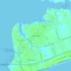
Bay of Saint Louis topographic map

Click on the map to display elevation.

About this map

Name: Bay of Saint Louis topographic map, elevation, terrain.

Location: Bay of Saint Louis, Pass Christian, Harrison County, Mississippi, United States (30.30522 -89.37866 30.37699 -89.24113)

Average elevation: 4 m

Minimum elevation: -4 m

Maximum elevation: 34 m

Other topographic maps

Click on a map to view its topography, its elevation and its terrain.
Gear up for your next adventure:

🎒Hiking Daypacks (20L) - Compact backpacks for day trips and technical mountain ascents
🚶Walking Pedometers - Simple distance tracking for casual trail walkers
🌦️Portable Weather Meters - Handheld tools for monitoring weather conditions
👟Men's Trail Running Shoes - Lightweight grip for fast movement over topographic contours
🍲Portable Camping Stoves - Fast-boiling stoves for hot meals on remote topographic survey trips

As an Amazon Associate, this site earns from qualifying purchases at no extra cost to you.