Geolocate

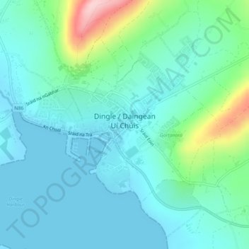
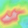
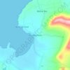
Dingle topographic map

Click on the map to display elevation.

Dingle

Dingle's St. Mary's is a neo-Gothic church built to designs by J. J. McCarthy and O'Connell. The foundation stone was laid in 1862. It originally had a nave and aisles separated by arcades, supported on columns capped by octagonal tops. The arcades were demolished in one of the most radical reordering schemes to have been executed in Ireland. The project also saw the demolition of the exterior walls to below the original clerestory level, and, most notably, of the attic and upper ranges of the west elevation.

Wikipedia (CC-BY-SA 3.0)

About this map

Name: Dingle topographic map, elevation, terrain.

Location: Dingle, County Kerry, Munster, Ireland (52.13074 -10.29854 52.15002 -10.25466)

Average elevation: 41 m

Minimum elevation: -1 m

Maximum elevation: 206 m

Other topographic maps

Click on a map to view its topography, its elevation and its terrain.
Glencloosagh Bay

Ireland > County Kerry

Average elevation: 12 m

Kenmare

Ireland > County Kerry > Kenmare

Average elevation: 87 m

Glencar

Ireland > County Kerry

Average elevation: 114 m

Knocknagashel

Ireland > County Kerry

Average elevation: 154 m

Brandon Mountain

Ireland > County Kerry

Average elevation: 572 m

Beaufort

Ireland > County Kerry

Average elevation: 41 m

Ballyduff

Ireland > County Kerry > Ballyduff

Average elevation: 29 m

Stradbally Mountain

Ireland > County Kerry

Average elevation: 487 m

Castlegregory

Ireland > County Kerry

Average elevation: 17 m

Murreagh

Ireland > County Kerry

Average elevation: 37 m

Brick

Ireland > County Kerry

Average elevation: 4 m

Kilmorna

Ireland > County Kerry

Average elevation: 65 m

Scartaglin

Ireland > County Kerry > Scartaglin

Average elevation: 135 m

Rathmore

Ireland > County Kerry > Rathmore

Average elevation: 154 m

Gear up for your next adventure:

GPS Outdoor Watches - Watches with GPS tracking for hiking and exploration
🔋Power Banks - Portable chargers for long outdoor trips
🧤Thermal Touchscreen Gloves - Stay warm while operating your GPS or smartphone camera
🧰Survival Kits - Emergency tools for remote environments
🧣Fleece Neck Warmers - Extra insulation for winter topographic surveys

As an Amazon Associate, this site earns from qualifying purchases at no extra cost to you.