Geolocate

Crozet topographic map

Click on the map to display elevation.

About this map

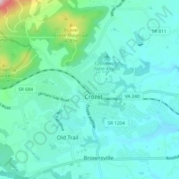
Name: Crozet topographic map, elevation, terrain.

Location: Crozet, Albemarle County, Virginia, 23932, United States (38.05056 -78.72809 38.07947 -78.65887)

Average elevation: 208 m

Minimum elevation: 147 m

Maximum elevation: 423 m

Gear up for your next adventure:

🧢Hiking Hats - Sun and weather protection for outdoor walks
🧭Emergency Beacons - Safety beacons for remote outdoor locations
🗺️Topographic Maps - Detailed maps showing elevation and terrain features
👖Convertible Hiking Trousers - Versatile zip-off pants for changing mountain weather conditions
🛰️Outdoor GPS Navigation - Navigation devices for remote and off-grid areas

As an Amazon Associate, this site earns from qualifying purchases at no extra cost to you.