
Thank you for supporting this site ❤️
Make a donation
Make a donation
Gear up for your next adventure:
As an Amazon Associate, this site earns from qualifying purchases at no extra cost to you.
Espinama topographic map
Click on the map to display elevation.
Thank you for supporting this site ❤️
Make a donation
Make a donation
Gear up for your next adventure:
As an Amazon Associate, this site earns from qualifying purchases at no extra cost to you.
About this map
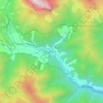
Name: Espinama topographic map, elevation, terrain.
Location: Espinama, Camaleño, Cantabria, 39588, Spain (43.10776 -4.80695 43.14776 -4.76695)
Average elevation: 1,156 m
Minimum elevation: 753 m
Maximum elevation: 1,822 m
Thank you for supporting this site ❤️
Make a donation
Make a donation
Gear up for your next adventure:
As an Amazon Associate, this site earns from qualifying purchases at no extra cost to you.