Geolocate

Ghatghar topographic map

Click on the map to display elevation.

About this map

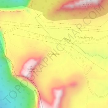
Name: Ghatghar topographic map, elevation, terrain.

Location: Ghatghar, Junnar, Pune District, Maharashtra, India (19.26231 73.67631 19.30231 73.71631)

Average elevation: 757 m

Minimum elevation: 269 m

Maximum elevation: 1,144 m

Gear up for your next adventure:

🗺️Ordnance Survey Maps - Official UK maps for walking and outdoor activities
🐕Dog Hiking Gear - Equipment for hiking safely with dogs
🦯Walking Poles - Supportive poles for long-distance walking
🥼Base Layers - Thermal base layers for temperature regulation
🧴Tick Removal Tools - Small, essential health tool for UK woodland and moorland

As an Amazon Associate, this site earns from qualifying purchases at no extra cost to you.