
Thank you for supporting this site ❤️
Make a donation
Make a donation
Gear up for your next adventure:
As an Amazon Associate, this site earns from qualifying purchases at no extra cost to you.
Lika topographic map
Click on the map to display elevation.
Thank you for supporting this site ❤️
Make a donation
Make a donation
Gear up for your next adventure:
As an Amazon Associate, this site earns from qualifying purchases at no extra cost to you.
About this map
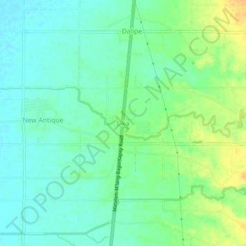
Name: Lika topographic map, elevation, terrain.
Location: Lika, M'lang, North Cotabato, Soccsksargen, 9402, Philippines (6.97035 124.87171 7.01035 124.91171)
Average elevation: 24 m
Minimum elevation: 12 m
Maximum elevation: 44 m
Thank you for supporting this site ❤️
Make a donation
Make a donation
Gear up for your next adventure:
As an Amazon Associate, this site earns from qualifying purchases at no extra cost to you.