Geolocate

Perry Hall topographic map

Click on the map to display elevation.

About this map

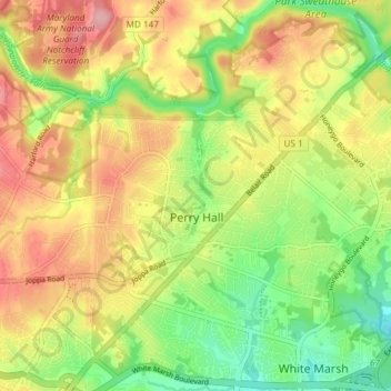
Name: Perry Hall topographic map, elevation, terrain.

Location: Perry Hall, Baltimore County, Maryland, 21236, United States (39.37856 -76.50376 39.43610 -76.44462)

Average elevation: 73 m

Minimum elevation: 11 m

Maximum elevation: 138 m

Gear up for your next adventure:

🦯Walking Poles - Supportive poles for long-distance walking
👖Packable Overtrousers - Quick-deploy rain protection for legs in sudden storms
👖Convertible Hiking Trousers - Versatile zip-off pants for changing mountain weather conditions
📕Outdoor Navigation Books - Learn traditional and modern navigation techniques
🧷Tenacious Repair Tape - Instant fix for torn tents, jackets, or dry bags

As an Amazon Associate, this site earns from qualifying purchases at no extra cost to you.