Geolocate

Swannanoa topographic map

Click on the map to display elevation.

About this map

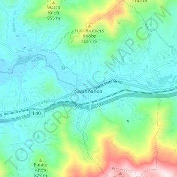
Name: Swannanoa topographic map, elevation, terrain.

Location: Swannanoa, Buncombe County, North Carolina, United States (35.57318 -82.42260 35.62807 -82.36641)

Average elevation: 796 m

Minimum elevation: 645 m

Maximum elevation: 1,302 m

Other topographic maps

Click on a map to view its topography, its elevation and its terrain.

Gear up for your next adventure:

📷Camera Straps - Secure straps for carrying cameras while walking
🥄Titanium Camping Sporks - The ultimate lightweight utensil for trail meals
🌂Windproof Trekking Umbrellas - Surprising but effective rain protection on low-wind trails
🛌Sleeping Mats - Insulated mats for comfortable outdoor sleeping
🗺️Ordnance Survey Maps - Essential paper maps for hiking across the UK national parks

As an Amazon Associate, this site earns from qualifying purchases at no extra cost to you.