

Kolhapur topographic map
Click on the map to display elevation.
Kolhapur
Kolhapur is an inland city located in south-west Maharashtra state, 373 km (232 mi) south of Mumbai and 228 km (142 mi) south of Pune, 615 km (382 mi) north-west of Bengaluru and 530 km (330 mi) west of Hyderabad. Within Maharashtra, Kolhapur's nearest cities and towns are Ichalkaranji 27 km (17 mi), Kodoli 35 km (22 mi), Peth Vadgaon 15 km (9.3 mi) Kagal 21 km (13 mi), Kasaba Walva 30 km (19 mi) Sangli 19 km (12 mi), Satara 115 km (71 mi). It lies in the Sahayadri mountains in the Western Ghats at an elevation of 569 m (1,867 ft). Tambraparni river dam near Umgaon village is close by, as also are Radhanagari and Kalambawadi dams. Panhala 21.5 km (13.4 mi) and Jyotiba Temple 21.7 km (13.5 mi) are in the vicinity of Kolhapur too.
About this map
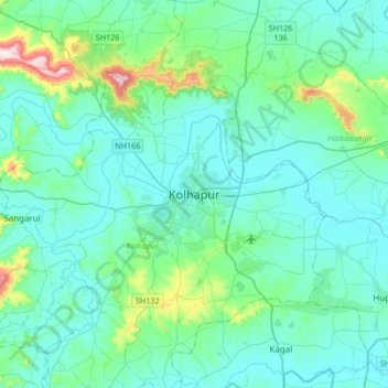
Name: Kolhapur topographic map, elevation, terrain.
Average elevation: 592 m
Minimum elevation: 532 m
Maximum elevation: 971 m
Other topographic maps
Click on a map to view its topography, its elevation and its terrain.
