Geolocate

Buxton topographic map

Click on the map to display elevation.

About this map

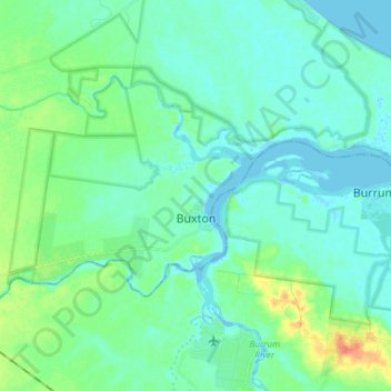
Name: Buxton topographic map, elevation, terrain.

Location: Buxton, Bundaberg Region, Queensland, Australia (-25.22833 152.41317 -25.14521 152.56204)

Average elevation: 9 m

Minimum elevation: -3 m

Maximum elevation: 42 m

Other topographic maps

Click on a map to view its topography, its elevation and its terrain.

Gear up for your next adventure:

🧘Folding Sit Mats - Dry and warm seat for map-reading breaks on damp ground
👟Heavy Duty Boot Laces - Always carry a spare for your hiking footwear
🪓Outdoor Multitools - Versatile tools for hiking and camping
🔋Solar Chargers - Eco-friendly charging solutions for outdoor use
👟Waterproof Leg Gaiters - Keep mud and water out of your boots in boggy terrain

As an Amazon Associate, this site earns from qualifying purchases at no extra cost to you.