
Thank you for supporting this site ❤️
Make a donation
Make a donation
Gear up for your next adventure:
As an Amazon Associate, this site earns from qualifying purchases at no extra cost to you.
Msaken topographic map
Click on the map to display elevation.
Thank you for supporting this site ❤️
Make a donation
Make a donation
Gear up for your next adventure:
As an Amazon Associate, this site earns from qualifying purchases at no extra cost to you.
About this map
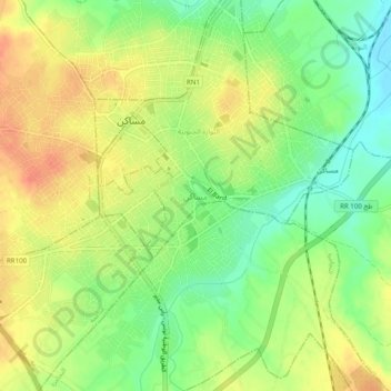
Name: Msaken topographic map, elevation, terrain.
Location: Msaken, التوارة الجنوبية, معتمدية مساكن, Sousse, 4099, Tunisia (35.70526 10.56328 35.74526 10.60328)
Average elevation: 45 m
Minimum elevation: 22 m
Maximum elevation: 65 m
Thank you for supporting this site ❤️
Make a donation
Make a donation
Gear up for your next adventure:
As an Amazon Associate, this site earns from qualifying purchases at no extra cost to you.