
Bàu Bàng District topographic map
Interactive map
Click on the map to display elevation.
About this map
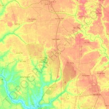
Name: Bàu Bàng District topographic map, elevation, terrain.
Location: Bàu Bàng District, Bình Dương Province, Vietnam (11.15138 106.50318 11.38774 106.72165)
Average elevation: 41 m
Minimum elevation: 1 m
Maximum elevation: 69 m
Other topographic maps
Click on a map to view its topography, its elevation and its terrain.
Thu Dau Mot City
Vietnam > Binh Duong province > Thu Dau Mot City > Thu Dau Mot City
Average elevation: 15 m